한국항공우주연구원
Mobile GnbSatellite Payload
Korea’s Cutting-Edge Satellites for Observing the Earth
Satellite
More countries are developing satellites, with more than 150 satellites launched each year worldwide. Earth observation satellites, meteorological/marine/environmental observation satellites, broadcasting/telecommunication satellites, and navigation satellites have an important role in national security and various fields such as economy, industry, and culture. The value of data observed from satellites is increasing as important big data in the 4th Industrial Revolution era.Securing satellite development technology to meet national public demand
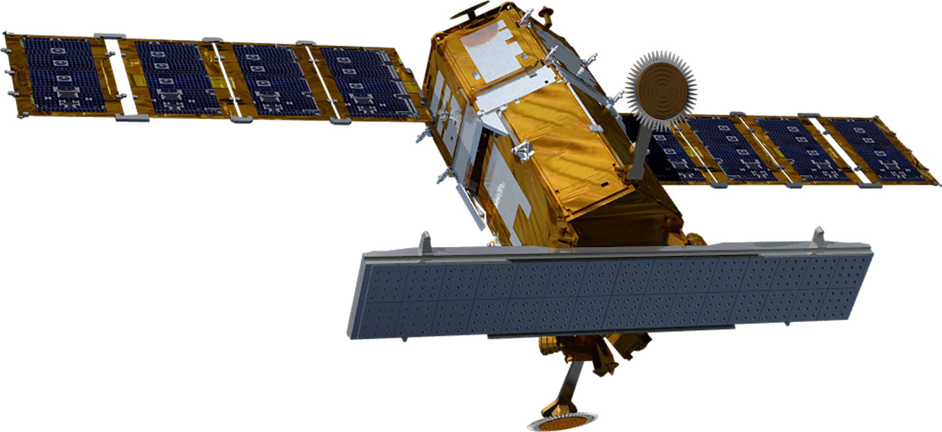
The research and development of satellites in Korea began in 1994 when the General Science and Technology Council approved a multipurpose satellite (Arirang) development project. The multipurpose Arirang 1 was developed in 1999 to meet public demand for satellite images, with Arirang 2 developed under the initiative in Korea in 2006. Later, Arirang 3, Arirang 5, and Arirang 3A were developed in 2012, 2013, and 2015, respectively. Currently, KARI is developing Arirang 6, a high-precision radar satellite, and Arirang 7 and Arirang 7A as cutting-edge precision earth observation optical satellites. Moreover, it developed Cheollian 1, Korea’s first geostationary orbit satellite capable of independent meteorological and ocean observation services. It also developed—and is currently operating—Cheollian 2A, which is capable of more precise meteorological observation than Cheollian 1, and Cheollian 2B, which is capable of marine observation as well as the world’s first atmospheric environmental observation from the geostationary orbit. In particular, Cheollian 2B is expected to help resolve conflicts between countries and social problems due to fine dust by identifying the migration path of air pollutants, such as fine dust, around the Korean Peninsula. KARI has also developed small and scientific experimental satellites, such as Science and Technology 1 in 2003 and Naro Science and Science and Technology 3 in 2013. KARI has secured its independent satellite development technology by developing multipurpose satellites and geostationary orbit satellites. 500kg next-generation mid-size satellites 1 was launched in 2021 to transfer satellite technology to private industry with the aim of industrialising domestic satellites.| Subject | Arirang (Multipurpose Satellite) | Next-Generation Mid-Size Satellite | ||||||||
|---|---|---|---|---|---|---|---|---|---|---|
| 1 | 2 | 3 | 3A | 5 | 6 | 7 | 7A | 1 | 2 | |
| Purpose | Earth observation (Optical) | Precise earth observation (Optical) | Precise earth observation (Optical) | Precise earth observation (Optical + IR) | All-weather earth observation (Image radar) | All-weather earth observation (Image radar) | Precise earth observation (Optical + IR) | Precise earth observation (Optical + IR) | Earth observation (EOS) | Earth observation (EOS) |
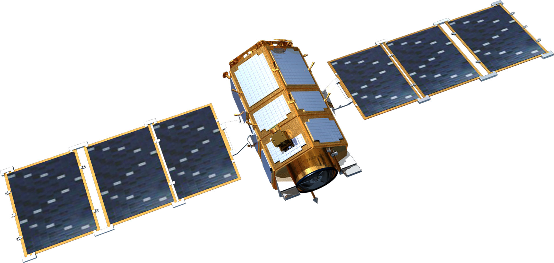
| Satellite Shape | 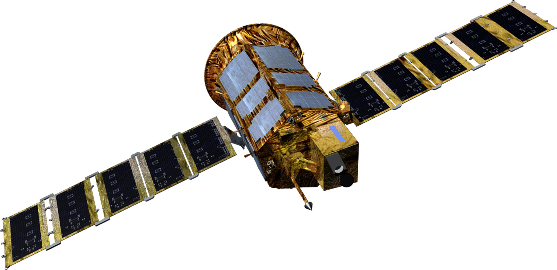 |
 |
 |
 |
 |
 |
 |
 |
 |
 |
| Project Period | 1994.11- 2000.1 | 1999.12 - 2006.11 | 2004.8 - 2012.8 | 2006.12 - 2015.12 | 2005.6 - 2015.6 | 2012 - 2014 | 2016 - 2023 | 2016 - 2023 | 2015 - 2019 | 2018 - 2020 |
| Weight(kg) | 470 kg | 800 kg | 980 kg | Around 1,100 kg | Around 1,400 kg | 1,750 kg | 2000 kg | 2000 kg | 500 kg class | 500 kg class |
| Mission Life | 3 years | 3 years | 4 years | 4 years | 5 years | 5 years | 5 years | 5 years | 4 years | 4 years |
| Performance (resolution) |
B&W 6.6m | B&W 1m Color 4m |
B/W 0.7m Color 2.8m |
B&W 0.55m Color 2.2m |
Radar image 1m/3m/20m | Radar image 0.5m/3m/20m | B&W 0.3m Color 1.12m |
B&W 0.3, color < 1.12m | B&W 0.5m Color 2m |
B&W 0.5m Color 2m |
| Launch Vehicle | Taurus (US) | Rockot (Russia) | H2-A (Japan) | Dnepr (Russia) | Dnepr (Russia) | Vega-C (France) | Vega-C (France) | Falcon9(US) | Soyuz-2 (Russia) | - |
| Launch Site | Vandenberg (US) | Plesetsk (Russia) | Tanegashima (Japan) | Yasny (Russia) | Yasny (Russia) | Guyana (France) | Guyana (France) | Cape Canaveral(US) | Baikonur (Kazakhstan) | - |
| Launch Date | '1999.12.21 | '2006.7.28 | '2012.5.18 | '2015.3.26 | '2013.8.22 | To Be Determined | To Be Determined | To Be Determind | '2021.3.22 | To Be Determined |
| Operation Status | Mission completed (2007.12) | Mission completed (2015.10) | In operation | In operation | In operation | Under development | Under development | Under development | In operation | Under development |
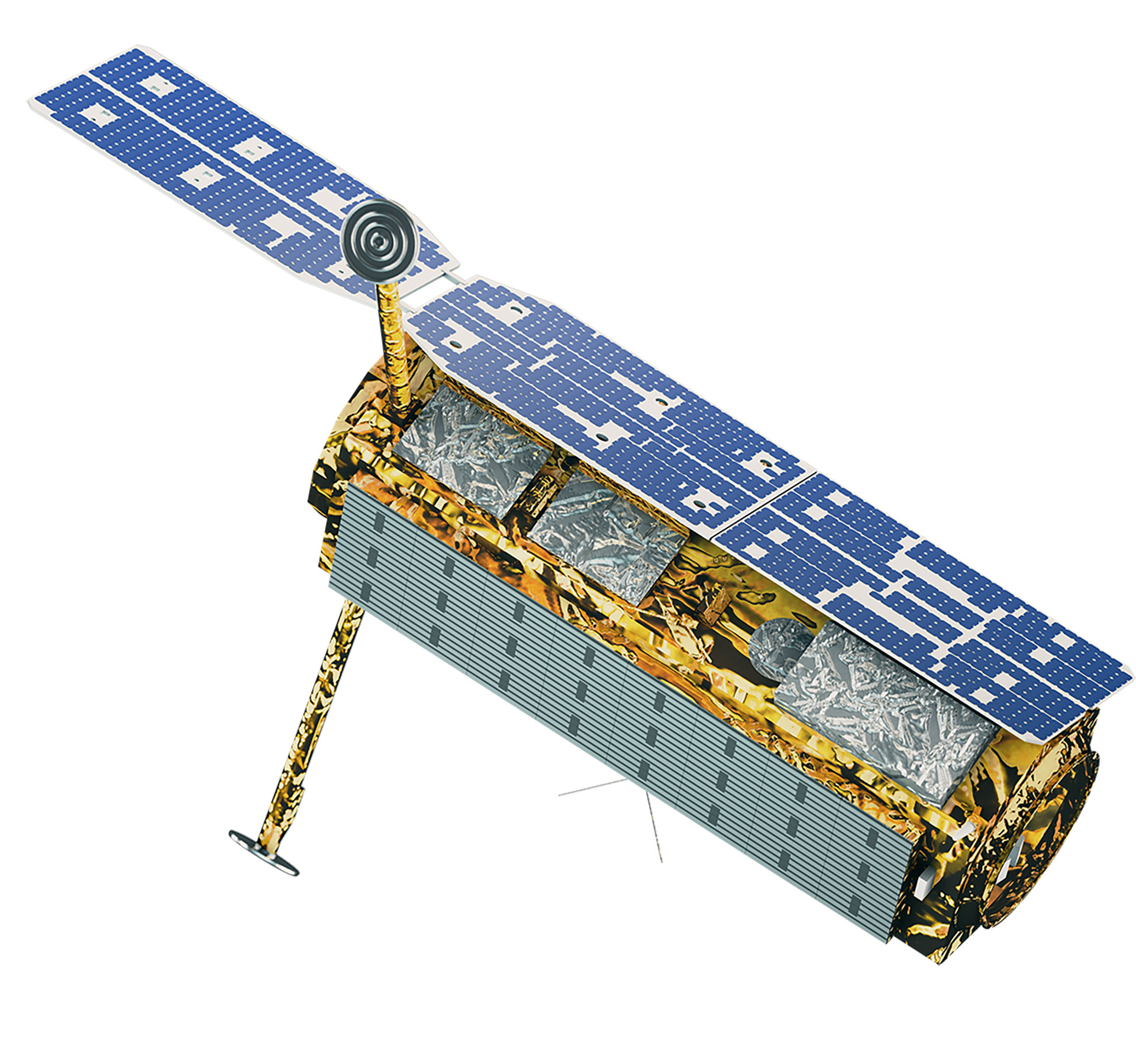
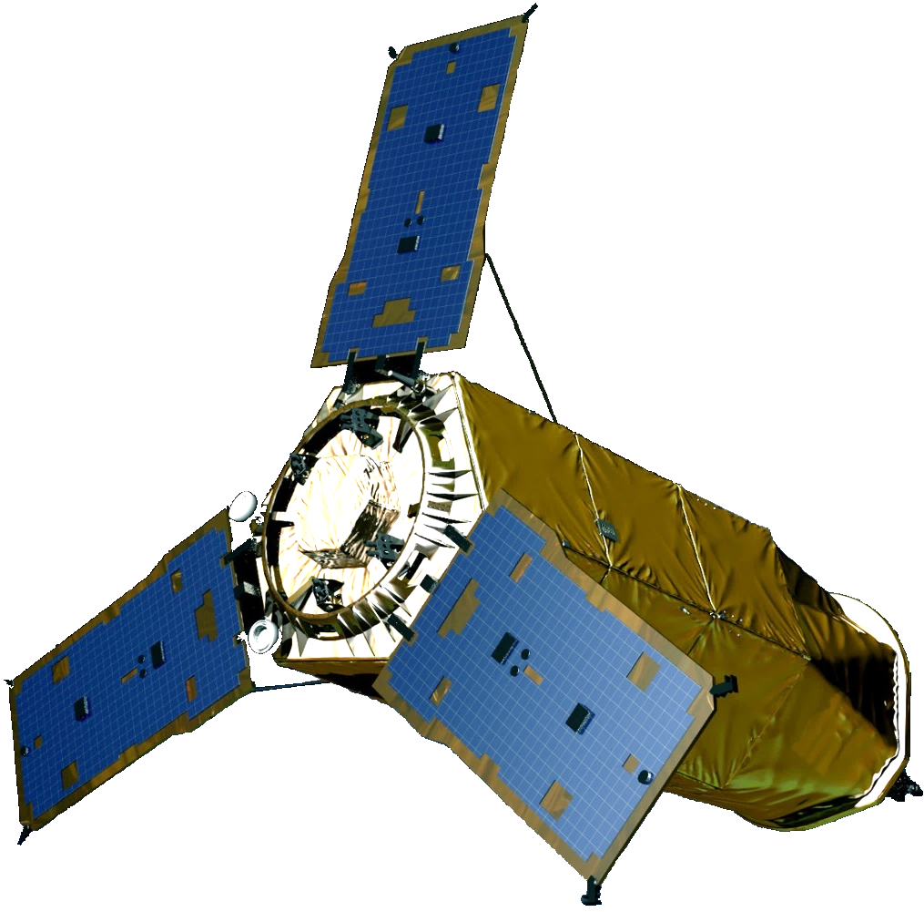
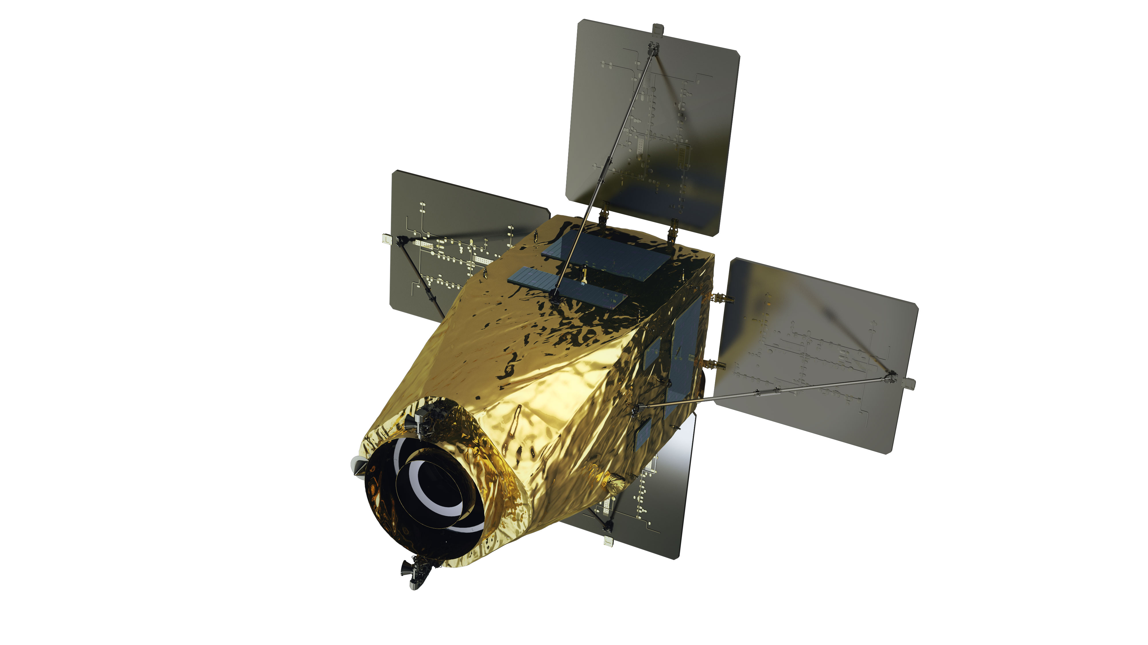
| Type | Public geostationary orbital satellite | |||
|---|---|---|---|---|
| Cheollian 1 | Cheollian 2A | Cheollian 2B | Cheollian 3 | |
| Purpose | Public communication/Marine/Weather observation | Weather/Spaceobservation | Marine/Environmentalobservation | Offering public satellite communication service |
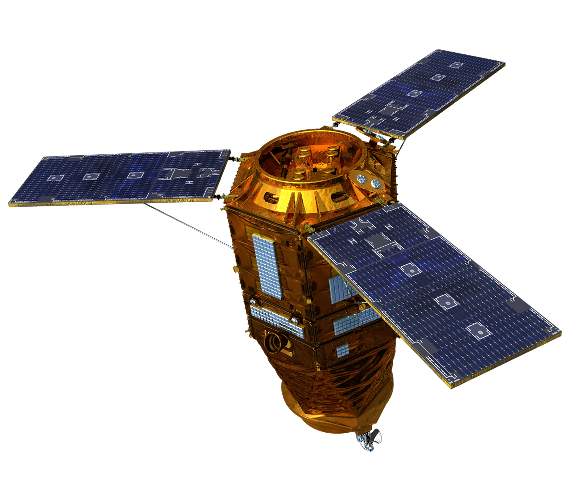
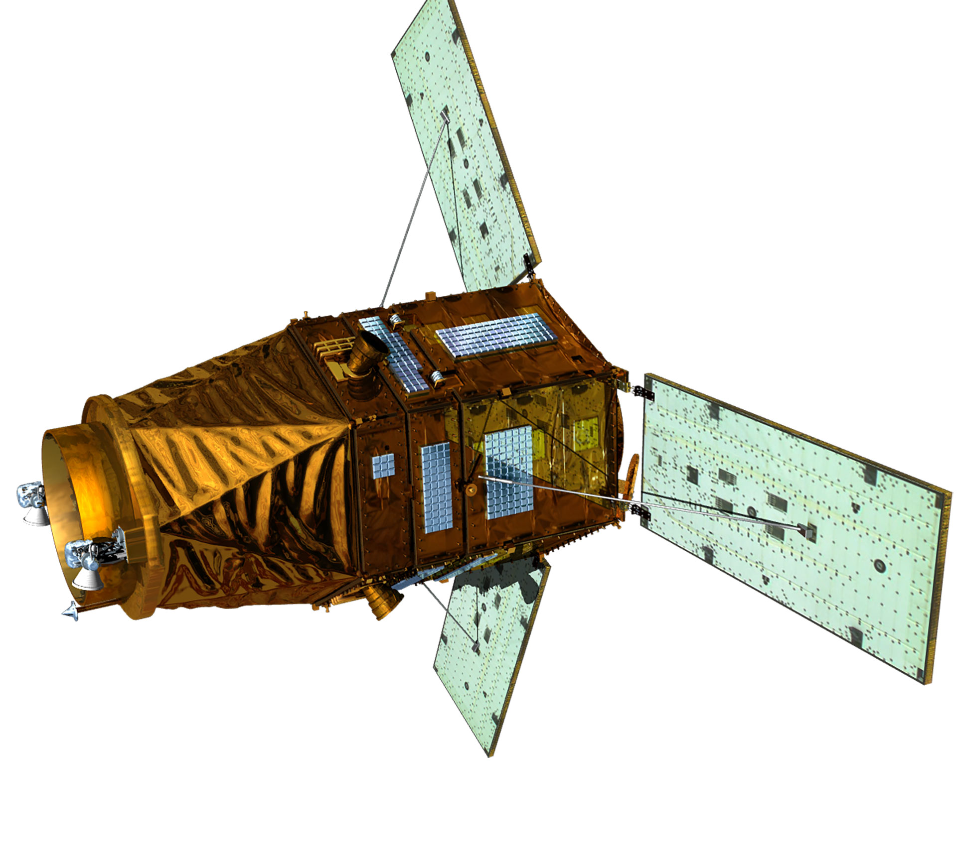
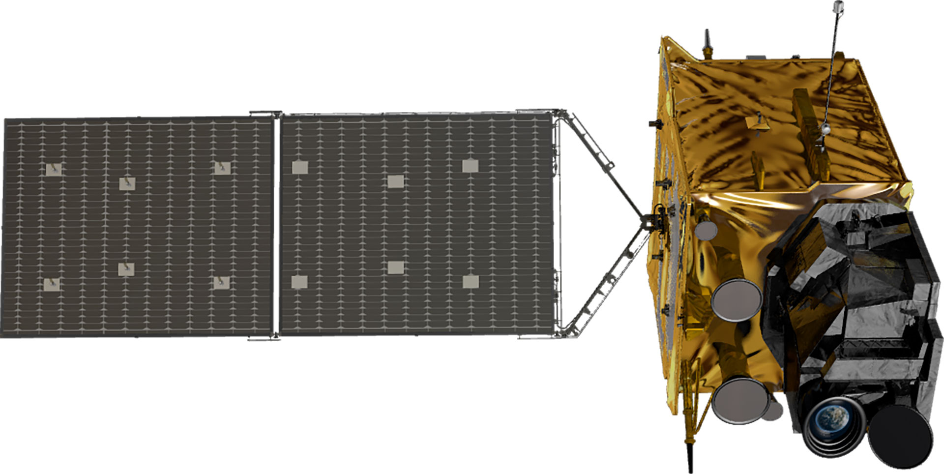
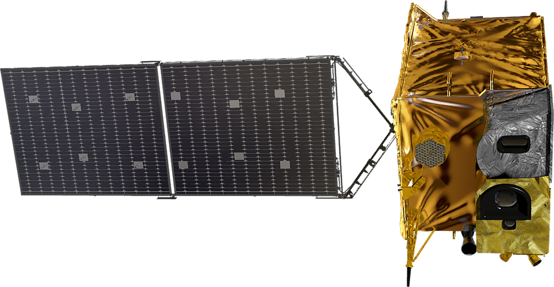
| Shape | 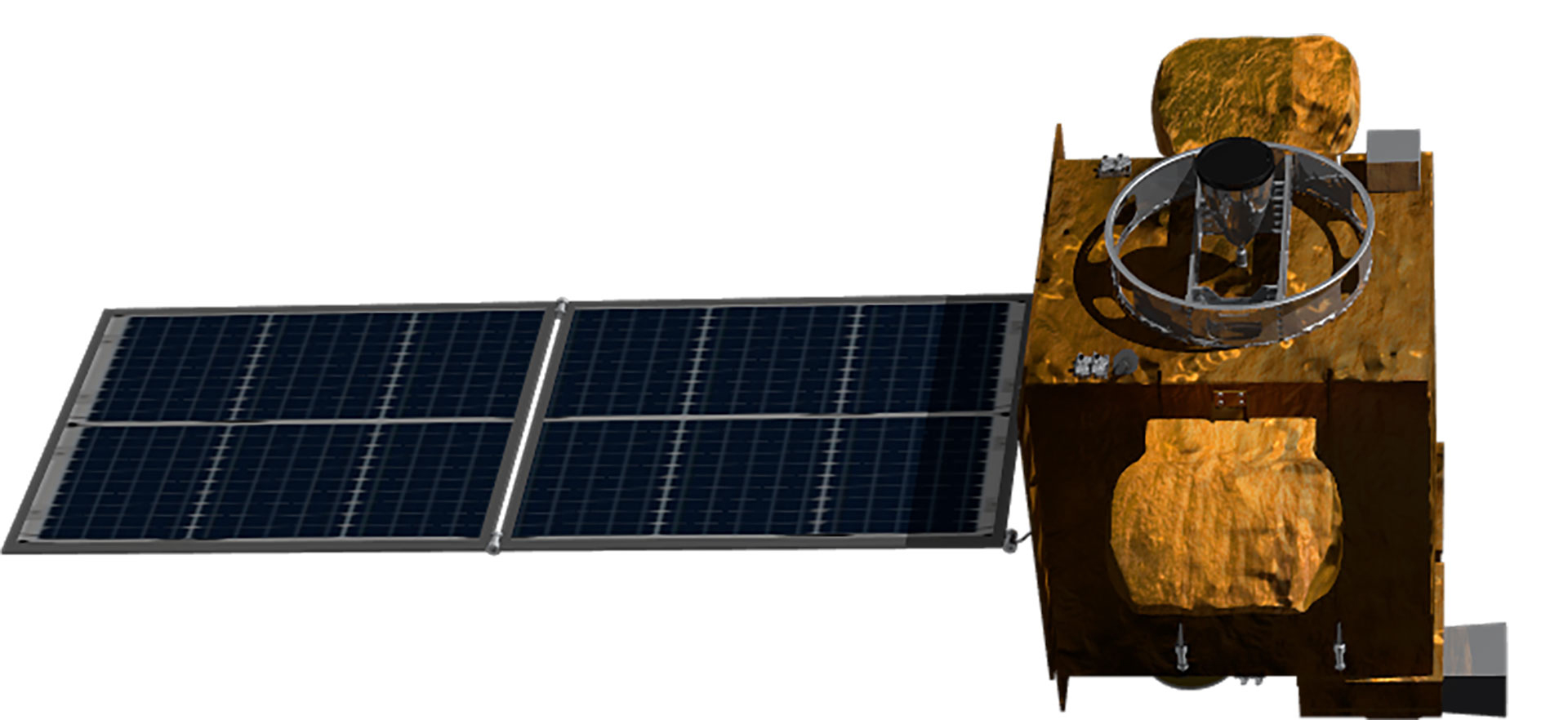 |
 |
 |
 |
| Development Period | 2003.9 - 2010.12 | 2011.7 - 2020.10 | 2021.4 - 2027.12 | |
| Launch Date | 2010.6.27 | 2018.12.5 | 2020.2.19 | To be Determined |
| Weight | 2,460 kg | 3,507 kg | 3,386 kg | 3,500 kg |
| Life | 7 years | 10 years | 10 years | 15 years |
| Satellite body development | Astrium(France)/KARIjoint development | KARI | KARI | KARI |
| Launch vehicle | Ariane5 (France) | Ariane5 (France) | Ariane5 (France) | - |
| Launch site | Guyana (France) | Guyana (France) | Guyana (France) | - |
| Remarks | Korea’s first geostationary orbital satellite | Geostationary orbital satellites independently developed in KOREA | ||
| Operation Status | Weather observation Mission completed (‘20.4.1) | In operation | In operation | Under development |
World-class satellite development technology
Although Korea was a latecomer, having begun developing satellites in the 1990s, it has come a long way thanks to continuous investment and R&D, and it is considered to be among the world's top six or seven in terms of satellite development capability. It has secured the world's most advanced satellite design, analysis, assembly, and test technologies to meet various domestic satellite demands. Having constructed a cutting-edge satellite testing facility, it owns satellite operation infrastructure and technology and satellite information utilization technology essential for satellite development. KARI has accumulated technologies for developing low-orbit earth observation satellites and geostationary satellites applying advanced technologies through world-class satellite research and development. It transfers its satellite development technologies to private industries.Satellite Payload
Localization of world-class high-resolution payload
atellites are equipped with various payloads depending on the purpose of the mission. Korea multipurpose satellite (KOMPSAT) and Compact advanced satellite 500 (CAS 500) are low-orbit earth observation satellites. They observe Earth with electro-optical , synthetic aperture radar (SAR), and IR payloads. Cheollian 1, Cheollian 2A, and Cheollian 2B, which are geostationary satellites, are respectively equipped with meteorological, marine, and environmental payload to perform meteorological, marine, and atmospheric environment observation missions. KARI develops original technologies to localize the core components of satellite payloads and develop next-generation payloads.Electro-optical payload (AEISS, Advanced Earth Imaging Sensor System)
An electro-optical payload is a camera that records the visible light band that the human eyes can see. Electro-optical cameras include optical mirrors that reflect light coming from the ground, high-stability telescope structure(HSTS) that supports the reflector and payload components, focal plane unit(FPU) that converts the light from the reflector into electronic signals, and camera electronics unit(CEU). KARI independently developed a world-class electro-optical payload, AEISS(Advanced Earth Imaging Sensor System), based on the technology acquired through the development of Arirang 1 and Arirang 2. Except for some parts, AEISS was developed with Korean technology from design to precise assembly, alignment, testing, and final verification in the simulated space environment.Ultra-precision technology available in very few countries
As a key component of an electro-optical payload, the reflector acts like a camera lens. The process of manufacturing the reflector surface requires precision at the level of cutting hair into thickness of 1/50,000. Moreover, the surface should be in an aspherical shape to prevent distortion of the image. It has to be made to bend the surface unevenly, requiring high level of skill. The Hubble Telescope's failure (550 nm) was also an error that occurred during processing measurements. Assembling and aligning the optical system require ultra-precision higher than 1/5,000 of the thickness of hair. It also needs high-level technology to block even the minute vibrations generated by cars' movement around people or buildings.
Moreover, the satellite has to withstand the load of several times the gravitational acceleration during the process of launch into space on a space launch vehicle and the temperature difference of more than 100oC in a vacuum environment while carrying out its mission for several years. That is why few countries such as the US and France have cutting-edge satellite electro-optical camera technology. High-performance electro-optical cameras cannot be developed through technology transfer or joint development. Therefore, it is important to secure high-performance electro-optical camera development technology independently.
Arirang 3 and Arirang 3A were equipped with AEISS(Advanced Earth Imaging Sensor System) and AEISS-A(Advanced Earth Imaging Sensor System-A), respectively. AEISS mounted in Arirang 3 is a 70cm-resolution electro-optical camera unit. AEISS can precisely identify vehicles moving on the ground while flying at 7km/s at an altitude of 700km.
KARI developed AEISS-A mounted in Arirang 3A as a succeeding model of AEISS. The optical resolution of AEISS-A is 55cm, and the camera is equipped with an IR channel to enable nighttime photography and heat detection with an IR sensor.
Arirang 7, which is currently under development, will be equipped with AEISS-HR (Advanced Earth Imaging Sensor System-High Resolution). AEISS-HR boasts of the world's highest optical performance level of 30cm. Arirang Satellite 7 is designed to acquire 30cm ultra-high-resolution images with optical unit measuring 1.5 times of 0.7m. KARI is independently developing the satellite using the core technologies it has acquired by developing existing optical satellites. They include satellite maneuvering and altitude stabilization, camera gravity-compensated optical system alignment, lightweight composite optical structure with high stability, optical transmission for real-time processing and storage of large-capacity image data, and storage of data-sized terra-bit or more. Moreover, real-time compression and encryption in high-speed parallel processing were developed to transmit stored images to the ground within a limited time. Arirang 7 is expected to show 3.4 times' vehicle type identification(including small cars and trucks) capability and improved maneuverability compared to Arirang 3A.
KARI plans to launch Arirang 7 equipped with a 30cm-class ultra-high-resolution camera next year. The subsequent satellite, Arirang 7A, will be equipped with a 25cm-class ultra-high-resolution camera. Few countries like the United States, Europe, and Japan currently have satellites equipped with a 30cm-class ultra-high-resolution camera.
KARI has used imported reflectors for up to Arirang 3, but the Space Core Technology Development Project successfully manufactured reflectors that could be used for satellites. As a result, the 50cm-class optical camera for Compact advanced satellite 500-1(CAS 500-1) will be equipped with Korea’s independently developed reflector. Except for photodetectors(CCD), the Compact advanced satellite 500-1(CAS 500-1) succeeded in localizing payload components, which had been completely dependent on overseas technology and achieved a localization rate of 98.6%. Moreover, Arirang 7’s 30cm-class optical system will also use some of the reflectors developed in Korea.


Image acquisition regardless of weather conditions, day and night
The synthetic aperture radar(SAR) generates images by emitting radio signals from a satellite and receiving signals reflected from an object. The synthetic aperture radar (SAR) has the advantage of acquiring images in all kinds of weather, day or night, regardless of weather conditions due to radio waves' characteristics. It can be used in various applications such as ice and snow, vegetation, ocean, and hydrological observations as well as topography identification and displacement detection by varying the frequency band (L, C, X, Ku band, etc.) and observation method (high resolution, standard, wide area). The imaging radar is mounted and operated on Arirang 5. The resolution is 1m in high-resolution mode, 3m in standard mode, and 20m in wide-area mode. It will also be mounted on Arirang 6, which is currently under research and development. The imaging radar of Arirang 6 has four times' (0.5m class) higher performance than that of Arirang 5, enabling the world's highest level of precise earth observation. Moreover, Compact advanced satellite 500-5(CAS 500-5) will be equipped with a C-band synthetic aperture radar(SAR) in the 5.4 GHz frequency band for the observation of water resources and water disasters. KARI is studying ways to reduce its form factor and weight to be loaded in the 500 kg standard body.Arirang 7A to be equipped with the highest-performance IR payload
The IR payload is a key device that observes the light wavelength's infrared region to detect and image heat generated by an object. Because of these characteristics, unlike an electro-optical camera, the IR camera can observe the steam/heating point for 24 hours during day and night. The IR sensor consists of an IR optical and mechanical assembly(IROMA), an infrared focal plane assembly(IRFPA) that detects infrared light and converts it into an electronic signal, and an IR control electronics unit(IRCEU). The infrared payload is mounted on Arirang 3A and is in operation. The IR sensor of the IR payload mounted on Arirang 3A for the first time in Korea was manufactured by a domestic company(Samsung Thales). Some components, such as infrared detectors, were developed through technical cooperation with overseas partners. The IR sensor of Arirang 3A has a middle observation wavelength band of 3.3~5.2μm, and it can estimate the surface temperature. Therefore, it can be used for forest fire detection, volcanic eruption detection, fire monitoring in oil wells or coal beds, flood damage analysis, urban heat island analysis, and hot wastewater dump surveillance. It can also detect red tides and monitor oil spills by collecting wavelength data.
KARI plans to load the IR payload on Arirang 7A, which is currently under development. Arirang 7A’s IR payload is expected to improve its world’s best level detection and observation performance even further with higher IR and maximize the area observation frequency by linking with Arirang 7.
Four times' higher resolution than Cheollian 1
The meteorological imager(MI) mounted on Cheollian 1 generates black and white images with one visible band and four infrared(IR) bands. The resolution of the visible and IR bands is 1km and 4km, respectively. It takes 30 minutes for Full Disk observation and 2 minutes for observation on the Korean Peninsula. With the images observed by MI, 16 types of meteorological outputs are generated through the meteorological data processing system of the National Meteorological Satellite Center. As the follow-on satellite of Cheollian 1, Cheollian 2A is a geostationary satellite to observe constantly the Earth weather over and surrounding the Korean Peninsula, as well as space weather. Equipped with the advanced meteorological imager (AMI), it exhibits the world best performance equivalent to the meteorological payload of GOES-16 and GOES-17 from the United States and Himawari-8 and Himawari-9 from Japan. Cheollian 2A’s meteorological payload(AMI) observes Earth weather with 4 visible bands and 12 IR bands to make true color images generated. The resolution of visible and IR bands is 0.5-1 km and 2 km, respectively. The AMI can perform 1 Full Disk observation, 5 East Asian regional observations, and 5 Korean peninsula observations in 10 minutes. The transmission rate of observation data is 115Mb per second which is 18 times faster than MI of Cheollian 1. Since color images allow tracking of various substances, such as yellow sand and volcanic ash, by type, the meteorological data processing system of Cheollian 2A can produce 52 types of meteorological outputs, which is three times those of Cheollian 1. With Cheollian 2A meteorological outputs, it is possible to provide in a timely manner, accurate and various weather data closely related to people's living, such as basic not only precipitation and snowfall, but also the effects of fine dust (aerosol), yellow sand, ozone, and volcanic ash on the atmosphere(detection of concentration at different altitudes).Performance Comparison of Cheollian 1 and Cheollian 2A
| Subject | Cheollian 1 | Cheollian 2A | Remarks | |
|---|---|---|---|---|
| Number of observation channels | 5 channels (1 visible and 4 IR) | 16 channels (4 visible, 2 near IR, and 10 IR) | 3 times faster | |
| Black&Whire | RGB true color | |||
| Spatial resolution | Visible image | 1km | 0.5~1km | 4 times enhanced |
| IR | 4km | 2km | ||
| Observation interval | Full Disk observation | 3 hours | 10 minutes | 6 times faster |
| Asia | - | 2 minutes | ||
| Korean Peninsula | About 8 times/hour | About 30 times/hour | ||
| Basic weather output | 16 types | 52 types | 3.5 times larger | |
World’s first marine observation from geostationary orbit satellites
KARI developed Cheollian 1’s marine payload(GOCI-I) to be the world’s first satellite to observe the ocean around the Korean Peninsula (2500km × 2500km) from the geostationary orbit. GOCI-I observes the Korean Peninsula 8 times a day with resolution of 500m and provides 8-channel data for each observation to produce 13 observation results. Cheollian 2B’s marine payload(GOCI-II) observes the ocean with 250 m resolution, which is 4 times the observation performance of Cheollian 1. It has 13 observation channels consisting of 9 visible light channels, 3 IR channels, and 1 broadband channel. Cheollian 2B’s marine payload(GOCI-II) is expected to produce 26 kinds of observation outputs, or twice as many as those of Cheollian 1, by observing the Korean Peninsula 10 times daily for 30 minutes and through daily global observation for 240 minutes. GOCI-II can monitor the ocean's carbon cycle as well as the marine environment such as red tide/green algae and salt concentration and marine pollution such as oil pollution. Moreover, it provides information on the predicted fishery environmental changes by observing the ocean's current circulation, fish food information, and sea surface temperature distribution. As such, the marine payload provides satellite-based convergence analytical data in semi-real time. It responds early to marine disasters/emergencies caused by marine abnormalities such as red tide/green algae by continuously monitoring the marine environment in the Korean territorial sea and exclusive economic zone. It can contribute to the production of forecast data for marine ecosystem changes caused by global climate change.Performance Comparison of Cheollian 1 and Cheollian 2B
| Subject | Cheollian Satellite 1 | Cheollian Satellite 2B | Remarks |
|---|---|---|---|
| Observation resolution | 500 x 500 m2 | 250 x 250m2 (@130E, 0N) | About four times' improvement |
| Number of observation channels | 8 channels (Visible: 6, near IR: 2) | 13 channels (Visible: 9, near IR: 3, filming stars: 1) | About 1.6 times' improvement (Added a channel for filming stars) |
| Number of observations | 8 times/day (No global observation) | Regional observation: 10 times/day Global observation: Once/day | About 1.3 times' improvement |
| Operating life | 7 Years | 10 Years | Increased operating life |
| Observation mode | Reference regional observation with solar correction | Reference area observation, global observation, selective regional observation, solar/lunar correction, filming of stars | Various observation modes available |
| Products | 13 types | 26 types | About two times' improvement |
Continuous observation of atmospheric pollutants from the geostationary orbit
The environmental payload(GEMS) mounted in Cheollian 2B is a hyperspectral imager that continuously observes Earth's atmospheric environment. It acquires images and spectral data that divide the UV and visible light band spectrum into 1000 fine wavelengths to produce information on the generation point and migration route of about 20 chemical substances like nitrogen dioxide, sulfur dioxide, and formaldehyde, which are precursors of short- and long-term climate change-causing substance, aerosol, and fine dust. GEMS observes atmospheric pollutants and climate change-causing substances on the Korean Peninsula and East Asia. It carries significance as the world's first geostationary environmental satellite launched 2-3 years earlier than the US and Europe. Using an environmental payload enables continuously observing atmospheric pollutants, which are currently observed only by low-orbit satellites, from the geostationary orbit for the first time in the world. It is expected to observe an area spanning 5,000× 5,000km in East Asia from the east of Japan to the Indochina Peninsula and from Northern Indonesia to Southern Mongolia 8 times a day for 30 minutes. Until now, fine dust monitoring and analysis have used meteorological satellites or ground observatories, and approximate flows have been available. Nonetheless, adding observation data acquired by the environmental payload improves forecast accuracy by monitoring atmospheric pollutants migrating long distances abroad. It is expected to contribute to improving people’s health and quality of life. Moreover, when TEMPO, the geostationary orbit environmental satellite being developed in the US, and Sentinel 4 UVN as the geostationary orbit environmental satellite being developed in Europe are launched along with Cheollian 2B, they are expected to monitor the entire process of generation, migration, and extinction of environmental pollutants in the global scope and identify the impact and interaction of the precursors.