Disaster Monitoring Activities
Disaster Monitoring Activitie
in JAPAN
in JAPA
February, 2012
February, 201
Takaaki IWASA
Takaaki IWAS
Director of Office for Space Utilization Promotion
Director of Office for Space Utilization Promotio
Ministry of Education, Culture, Sports, Science and Technology
Ministry of Education, Culture, Sports, Science and Technology
(MEXT)
(MEXT
Ministry of Education, Culture, Sports,
Ministry of Education, Culture, Sports,
Science and Technology
Science and Technology – Japan
Japa

2
Contribution of satellites to
the disaster monitoring
~
3.11 The Great East Japan Earthquake
~
The toughest and most difficult crisis for Japan
The toughest and most difficult crisis for Japan
since the WW
since the W
Ⅱ
Giant earthquake and tsunami
Giant earthquake and tsunam
The huge area along the Pacific ocean was devastated.
The huge area along the Pacific ocean was devastated
Tens of thousands of deaths, lost of houses, destructed s
Tens of thousands of deaths, lost of houses, destructed ocial
ocial
infrastructures, industries, agriculture and fishery.
infrastructures, industries, agriculture and fishery.
Fukushima dai
Fukushima da -ichi nuclear power station crisis
ichi nuclear power station crisi
The nuclear power station was destroyed by the tsunami an
The nuclear power station was destroyed by the tsunami a d people
d peopl
around are suffered from radiation hazards, evacuation an
around are suffered from radiation hazards, evacuation a d electricity
d electricity
shortage.
shortage.
We are most grateful for world wide sympathy
We are most grateful for world wide sympath
and great help to Japan.
and great help to Japan
3
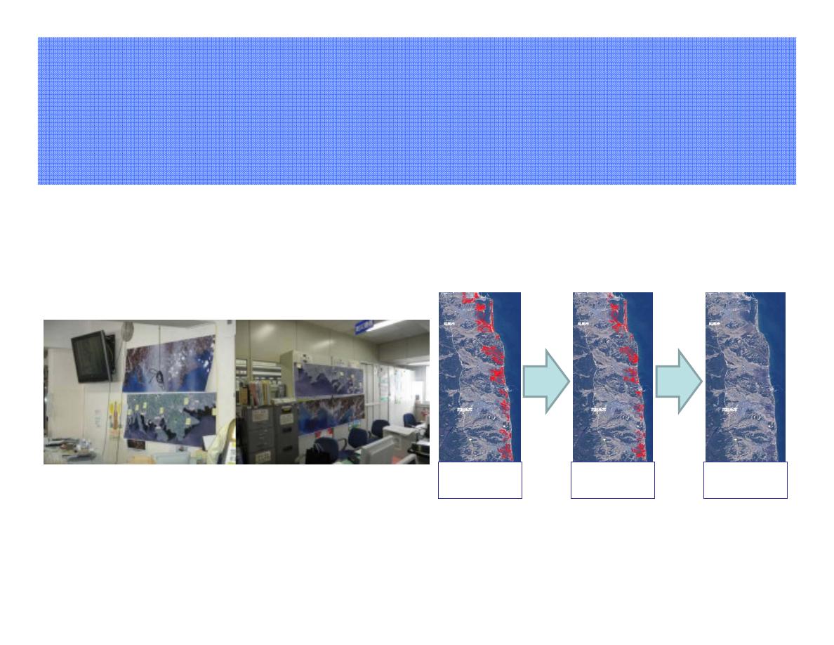
It was proved that the earth observation satellites
It was proved that the earth observation satellites
were useful for disaster monitoring
were useful for disaster monitoring
14th March
25.902[km2]
5th April
13.943[km2]
20th April
0.094[km2]
Monitoring the flooded area in Soma, Fukushima
prefecture
(Red = flooded area)
Disaster management room in Iwate prefecture
- Utilization of the ALOS data
Utilization of the ALOS data -
Contribution of satellites to
the disaster monitoring
~
3.11 The Great East Japan Earthquake
~
4
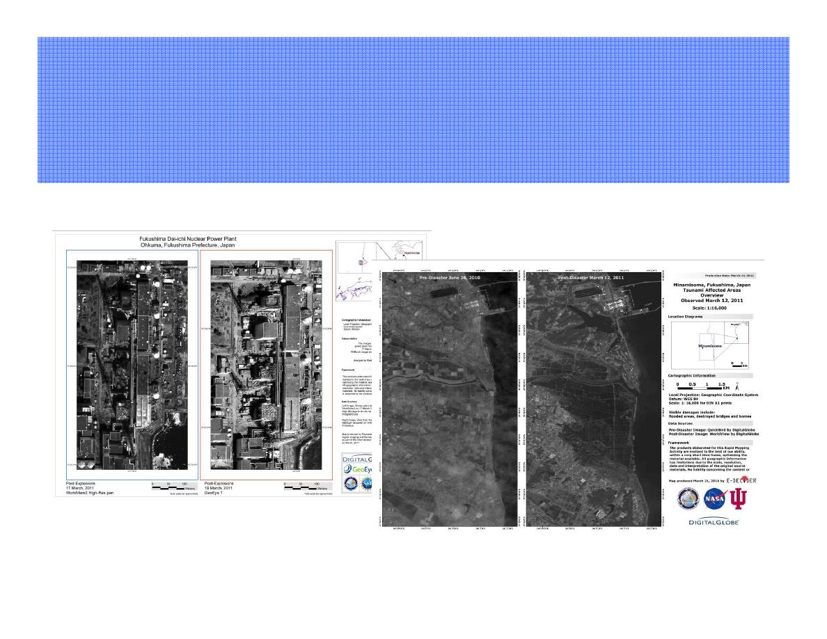
Images
Image **
* delivered through
delivered through
the Internationa
the Internation l Charter
l Charter
Fukushima dai-ichi nuclear power staion
( left: WorldView-2 right: GeoEye-1 )
Flooded area,
Minamisoma, Fukushima Prefecture
( left: QucikBird right: WorldView )
Contribution of satellites to
the disaster monitoring
~
3.11 The Great East Japan Earthquake
~
5
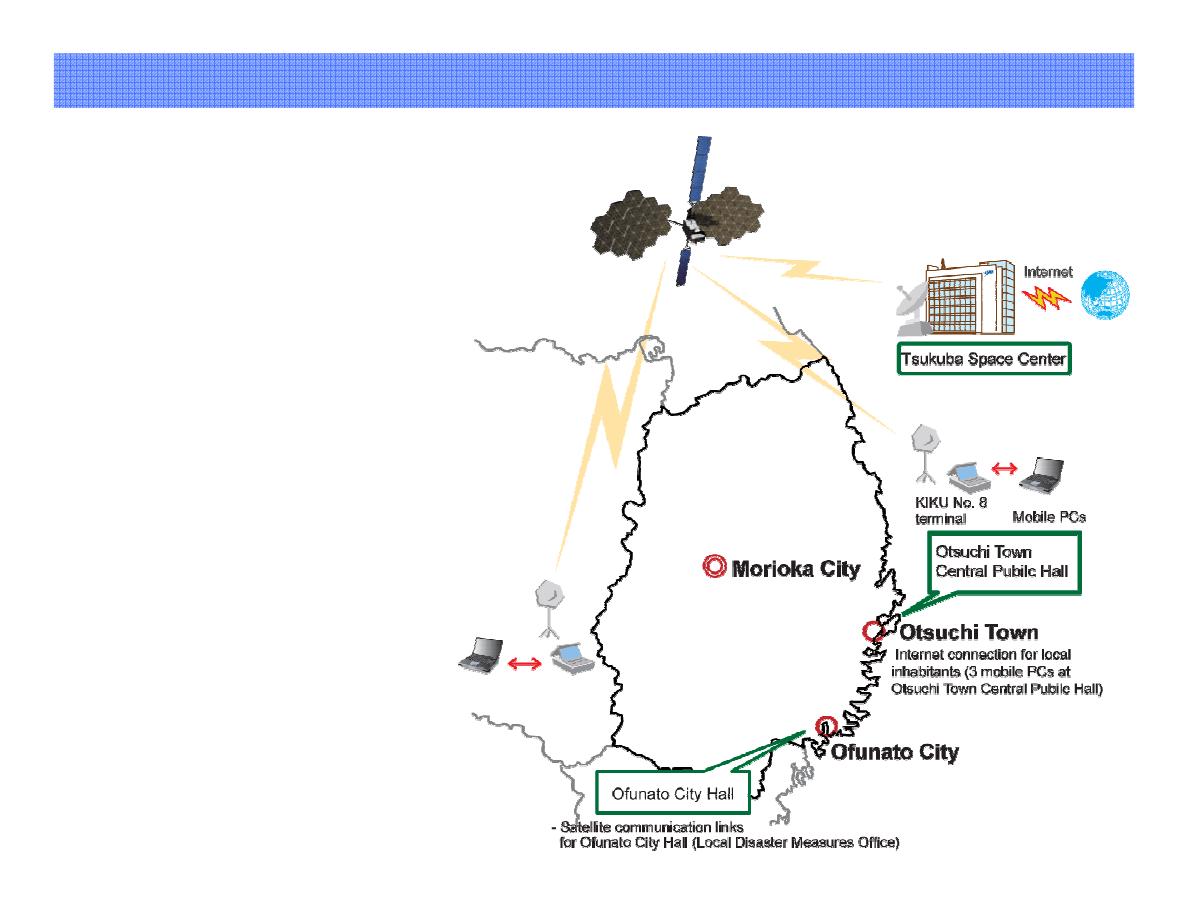
Provision of satellite communication : KIKU-8
23 March:
Departure from JAXA Tsukuba
Space Center
24 March:
Setting up ground antenna and
the movable test communication
terminal for the KIKU No. 8
at Ofunato City Hall.
4 April :
Setting up at Otsuchi Town
26 April:
Setting up at Onagawa Town
21 May 21:
Connection completed
“KIKU-8”
6
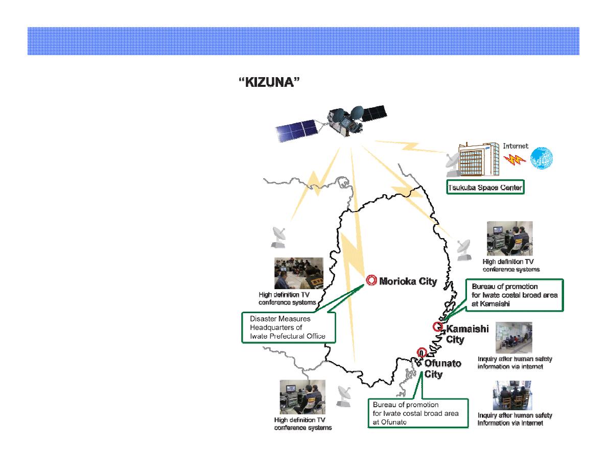
Provision of satellite communication : KIZUNA
6
17 March:
Arrival at Iwate Pref. Office
20 March:
Setting up communication line
between the Iwate Prefectural Office
(emergency response headquarters)
and Kamaishi City (Local
emergency response headquarters)
24 March:
Setting up ground antenna
at Ofunato City, and
completing communication
lines in three points
24 April :
Connection completed
7
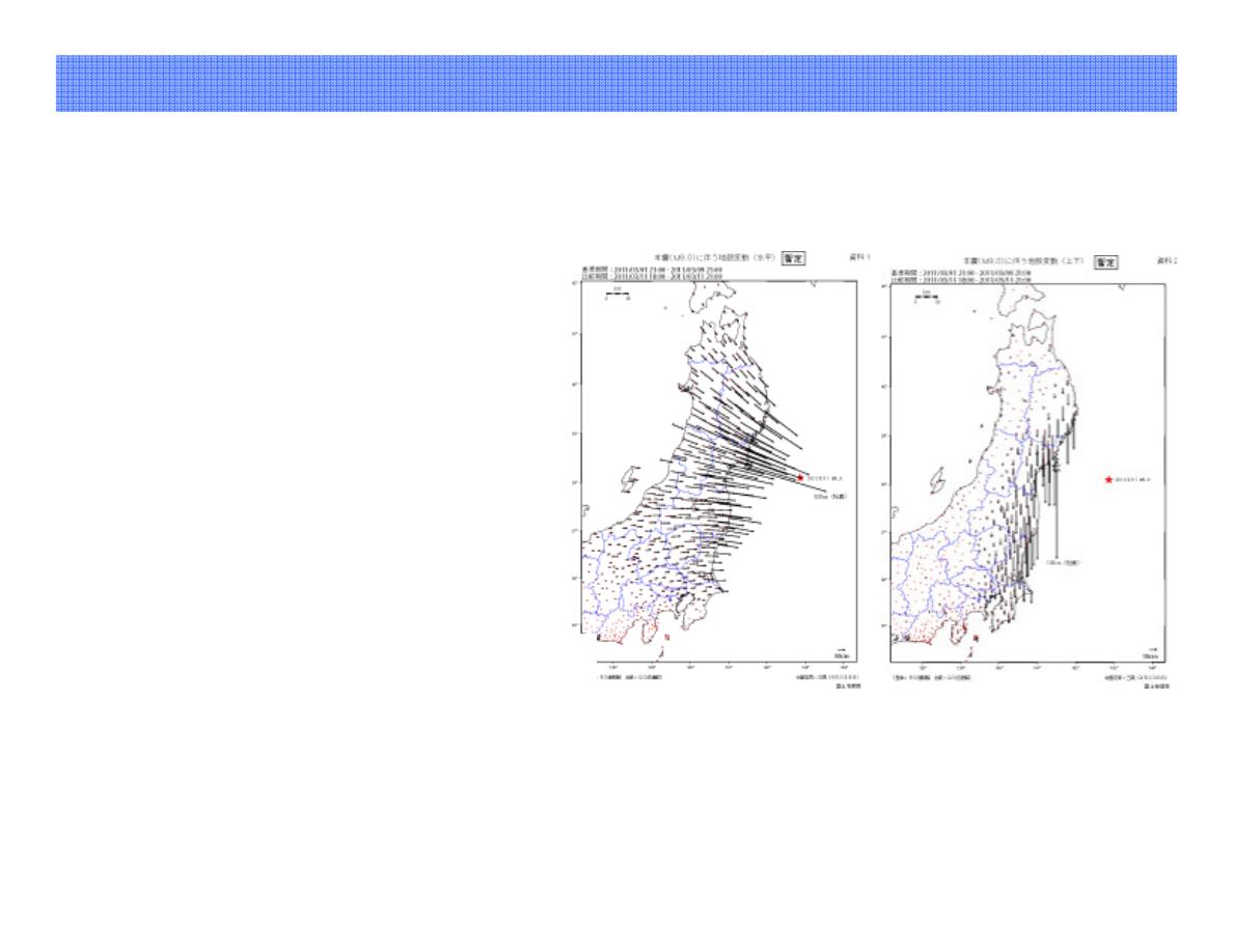
Utilization of GPS
Crustal Deformation of GPS-
based Control Station
• According to the analysis of
Geospatial Information
Authority of Japan, the Oshika
Peninsula shifted east-
southeast about 5.3 m and
subsided about 1.2 m due to the
earthquake.
Copyright: Geospatial Information Authority of Japan
Wave shape observed by GPS
wave recorder.
• According to the analysis of
Port and Research Institute,
there were seven big waves and
its maximum height was over
6m at the first wave.
8
=
Structure
Structur
=
Sentinel Asia
Sentinel Asi
APRSAF*
Space Community
Promotion of utilization
Capacity building
Disaster management
community
Utilization (User)
ADRC**
Member Countries
UN / ESCAP UN / OOSA
ASEAN AIT etc.
International community
** Asian Disaster
Reduction
Center
Joint Project Team (JPT)
consisting of 78 organizations
as of November 2011
* Asian-Pacific
Regional
Space Agency
Forum
Data provision
International Cooperation
Overview of Sentinel Asia(1/5)
9
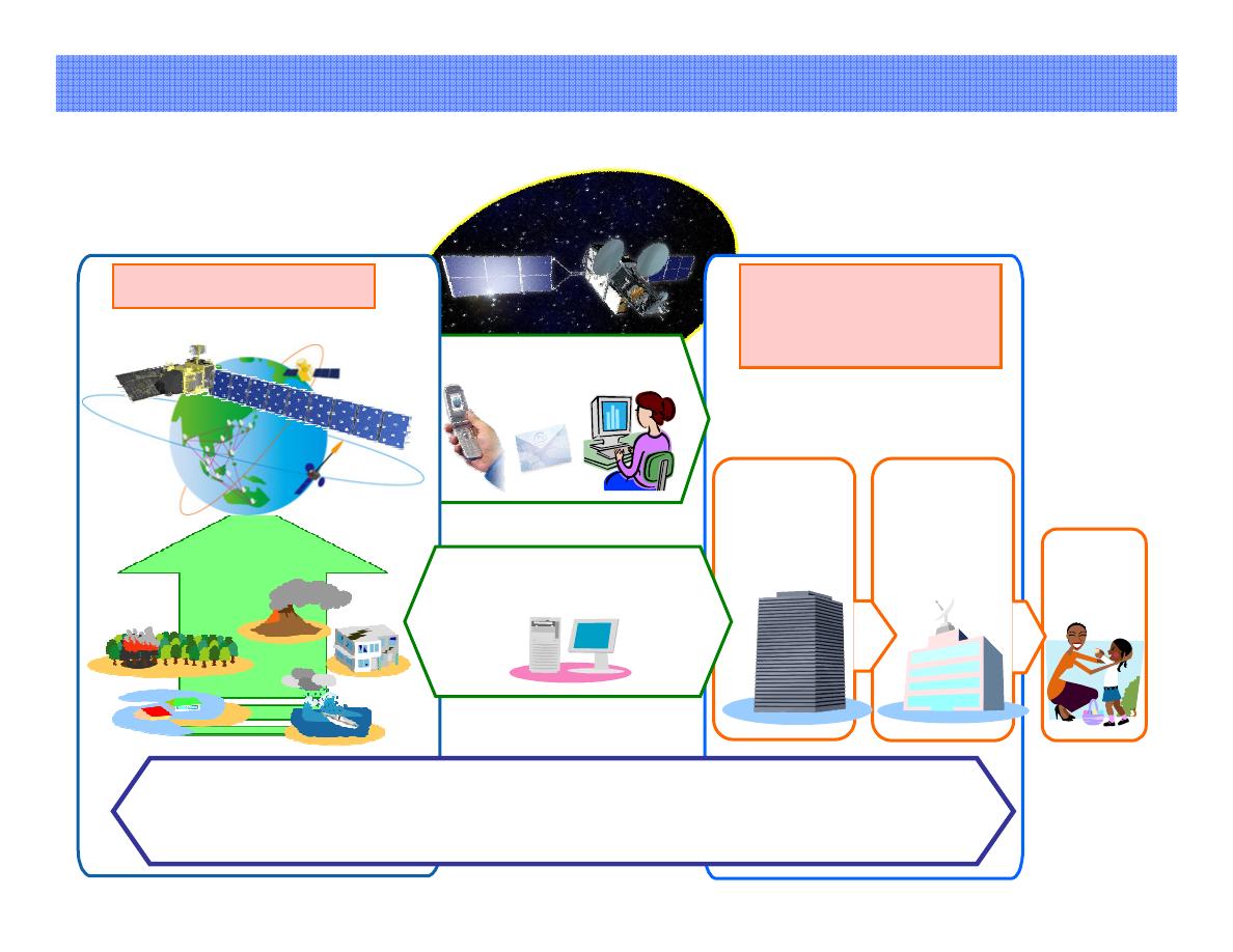
Observation
Observatio
Observati
Utilization
Utilizatio
Utilizati
End User
User Expansion
Transmission
@
Disaster
Management
Organization
Human Network
Capacity Building, Outreach
Sharing (Web)
Disaster Information
Wideband InterNetworking engineering test
and Demonstration Satellite “KIZUNA” (WINDS)
Wideband InterNetworking engineering test
and Demonstration Satellite “KIZUNA” (WINDS
Space Agency
Earth Observation Satellites
Value-added
Information
Governmental
Organization
(ADRC members)
Local
Governmental
Organization
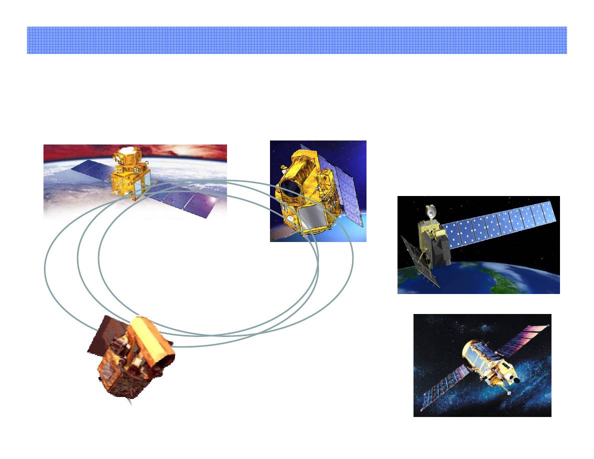
Overview of Sentinel Asia(2/5)
= Concept =
= Concept
10
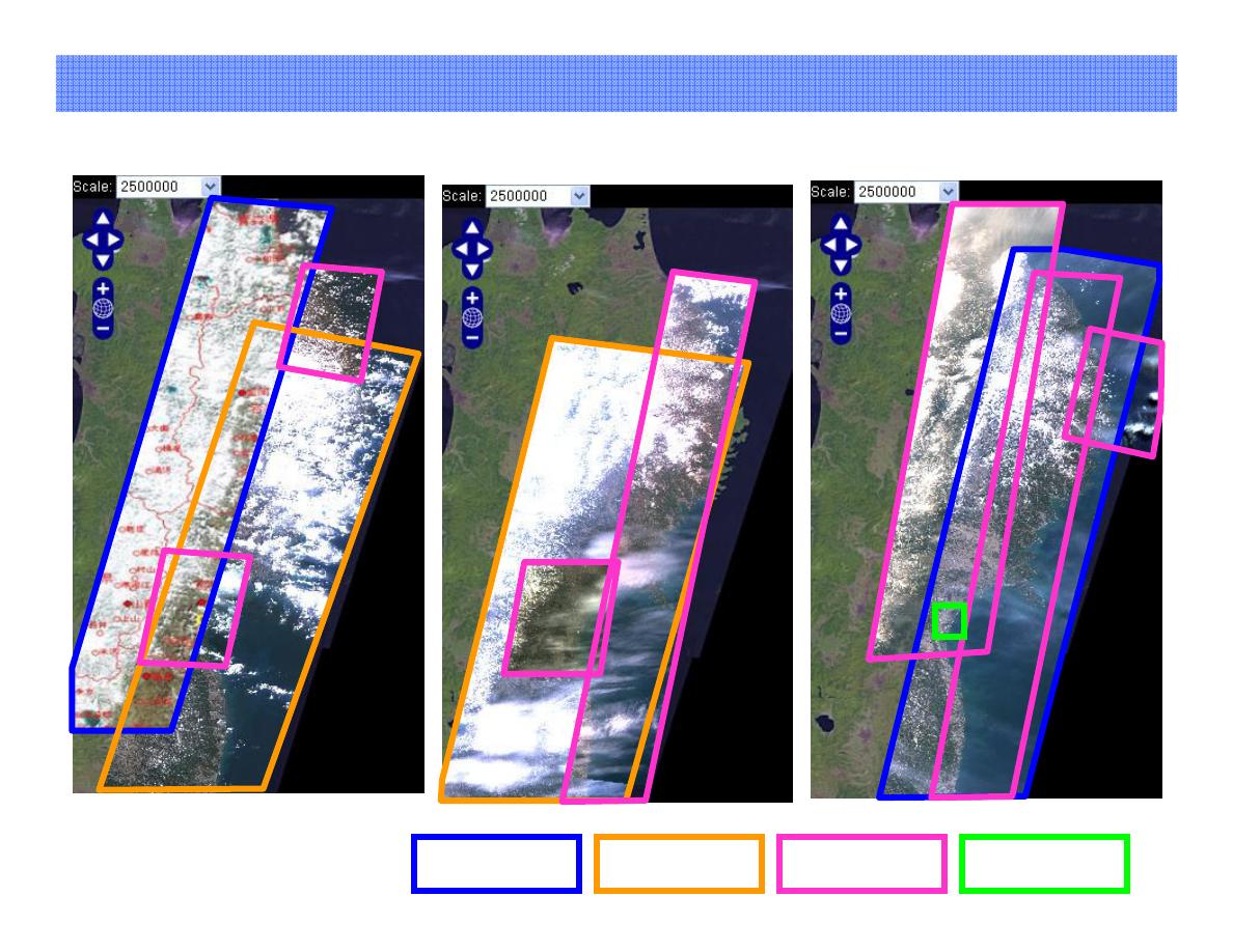
= Data provider node =
= Data provider node
THEOS
PAN: 2m
Multi: 15m
LISS
LIS -4: 5.8m Pan
4: 5.8m Pa
LISS
LIS -3: 23.5m Multi
3: 23.5m Mult
AWiFS: 56m Multi
AWiFS: 56m Mult
IRS
PRISM: 2.5m Pan
AVNIR-1: 10m Multi
PALSAR: 10-100m L-Band
ALOS
EOC: 6.6m
OSMI: 1km
KOMPSAT-1
JAXA
ISRO
KARI
GISTDA
NARL
FORMOSAT-2
Sentinel Asia
Sentinel Asia
Constellation
Constellatio
PAN: 2m
MS: 8m
Overview of Sentinel Asia(3/5)
11
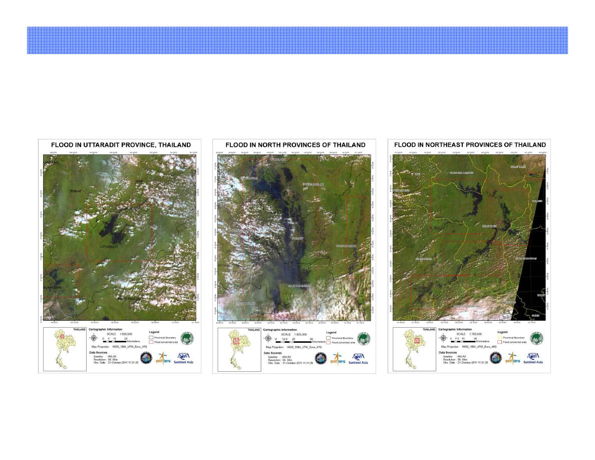
= 3.11 The Great East Japan Earthquake =
= 3.11 The Great East Japan Earthquake
12 March 2011
FORMOSAT-2
THEOS
ALOS
13 March
14 March
Overview of Sentinel Asia(4/5)
CARTOSAT-2
12
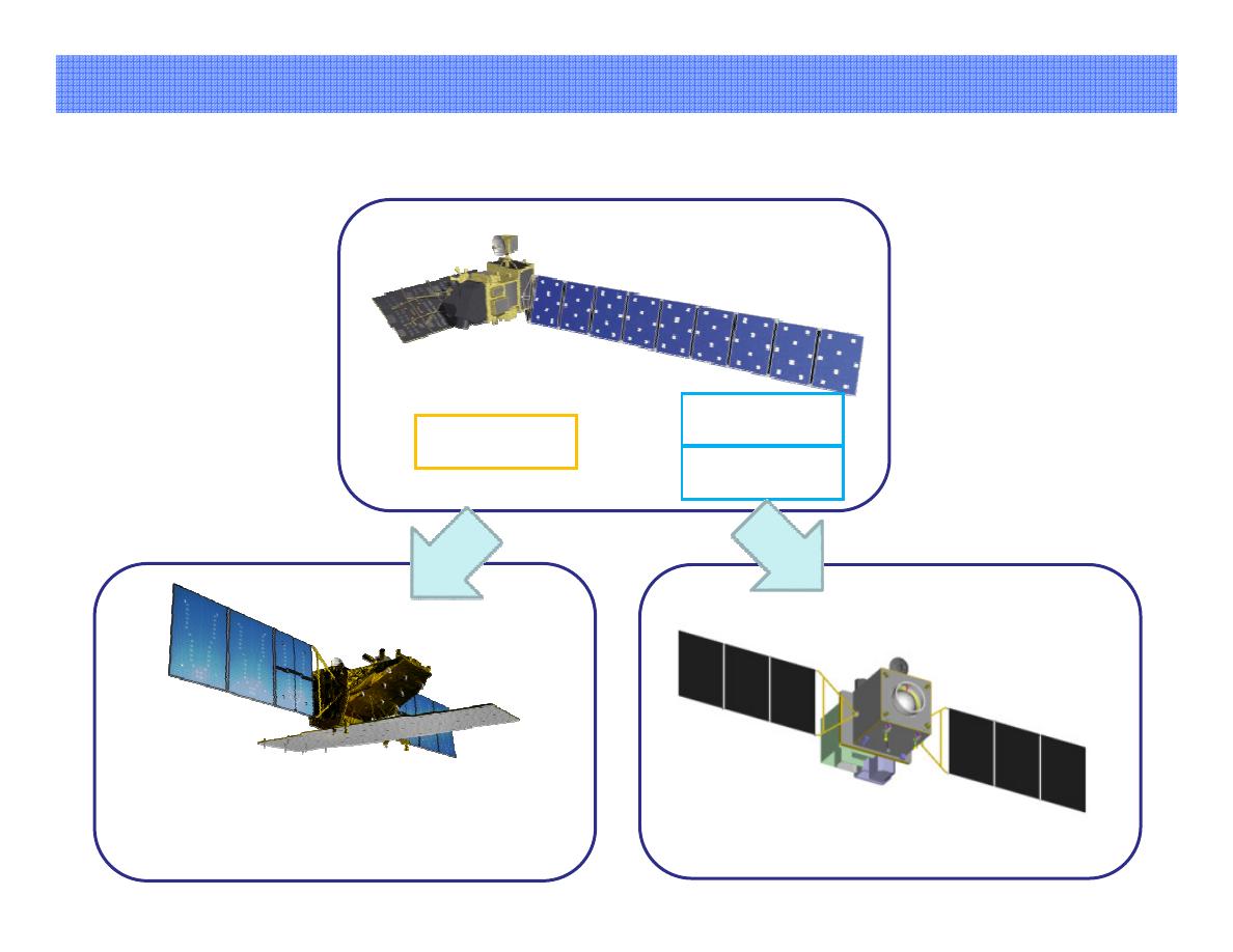
= Flood in Thailand =
= Flood in Thailand
observed by IRS on Oct./23/2011
observed by IRS on Oct./23/201
Uttaradit Province
North Province
Northeast Province
Overview of Sentinel Asia(5/5)
13
ALOS-2 (SAR satellite)
Launch 2013(Planned)
ALOS
PALSAR
PRISM
AVNIR-2
ALOS-3 (Optical satellite)
Launch 2015(Planned)
Jan. 2006-May 2011
R&D for Disaster monitoring satellite system
ALOS to ALOS
ALOS to ALO -2 and ALOS
2 and ALO -3
14
International Disasters Charter
International Disasters Chart
International Disasters Char
International Disasters Cha
LANDSAT
LANDSA
LANDS
LAND
-5,
5 -7
EO-1
IKONOS
IKONO
IKO
IK
GeoEye
GeoEy
GeoE
Geo
Quickbird
Quickbir
Quickb
Quick
-2
Worldview
Worldvie
Worldv
World
-1,
1 -2
Cartosat
Cartosa
Cartos
Carto
-2
ENVISAT
ENVISA
ENVIS
ENV
RADARSAT
RADARSA
RADARS
RADAR
-2
KOMPSAT
KOMPSA
KOMPS
KOM
-2
HJ
H
TerraSAR
TerraSA
TerraS
Terra
-X,RapidEye
X,RapidEy
X,RapidE
X,Rapid
SPOT
SPO
S
-4,5
4
Sentinel Asia
Sentinel Asi
Sentinel As
Sentinel A
THEOS
THEO
THE
TH
FORMOSAT
FORMOSA
FORMOS
FORMO
-2
COSMO-SkyMed
COSMO-SkyMe
COSMO-SkyM
COSMO-Sky
DEIMOS-1
DEIMOS-
DEIMOS
DEIMO
RubaiSAT
RubaiSA
RubaiS
Ruba
Resurs-DK
Resurs-D
Resurs-
Resurs
Individual offer
DubaiSAT
Japan is now recovering from the
huge disaster of Great East Japan
Earthquake.
We sincerely appreciate great
supports from
all over the world!
Thank you for your attention.